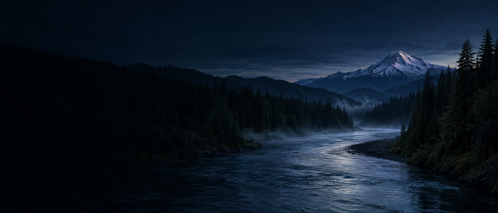
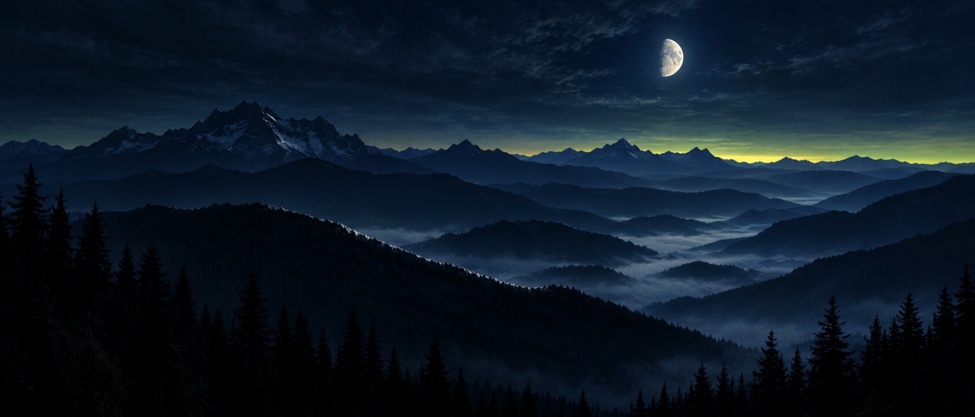
A river bending through dark fir forest at blue hour, mist on the water, a snow peak behind

The community-built outdoor app

You request it.
We build it.

Baseline Maps is shaped by the people who use it every weekend. Tell us what's missing (a river, a map layer, a fix) and watch it ship, usually within the week. 1,300+ rivers, 1,300+ hunting units, first week free.

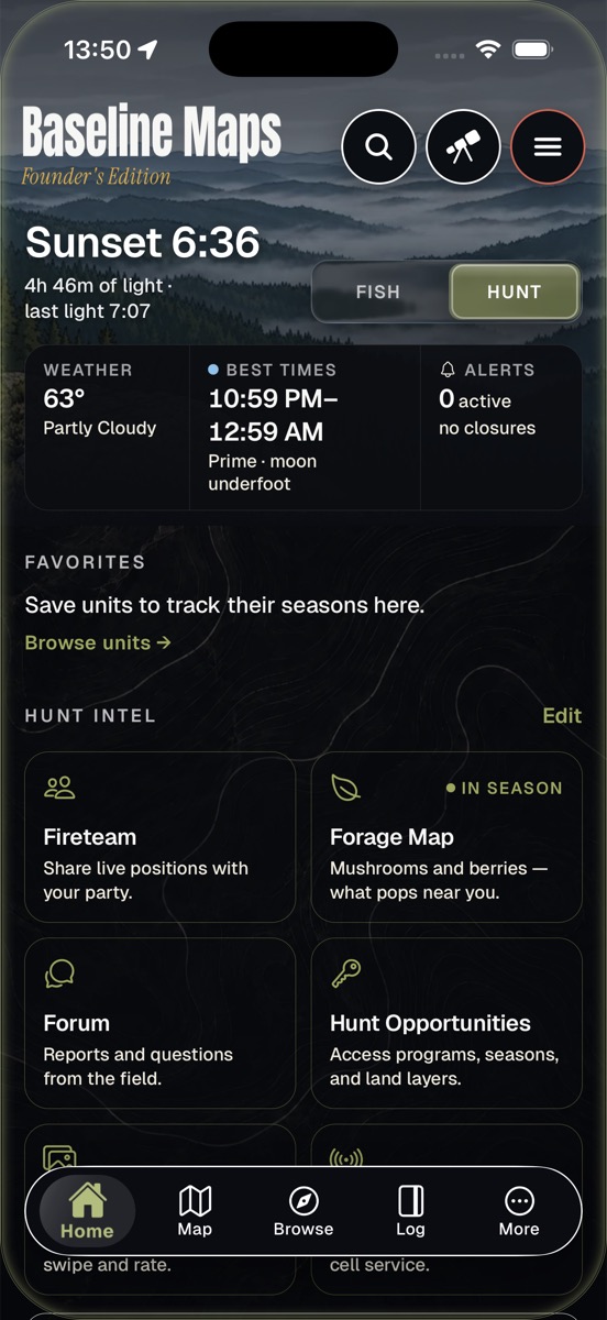
Home screen in Hunt mode with sunset time, best times, and Hunt Intel tiles
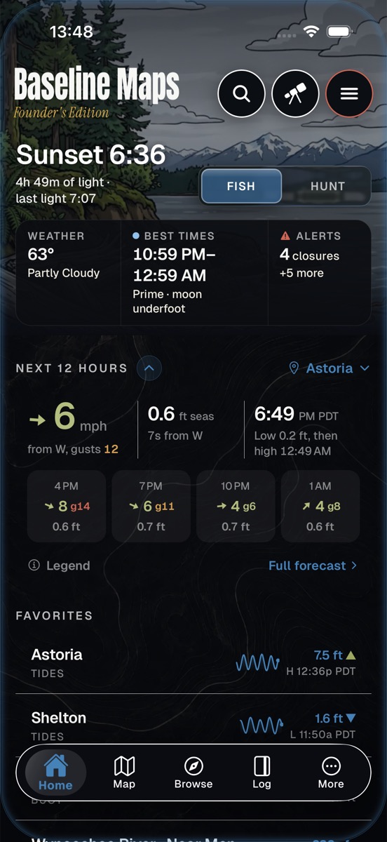
Home screen in Fish mode showing weather, best times, alerts, the next 12 hours of wind and seas, and favorite tide stations
Driftline modeFishing

Know the water before you load the boat.

Real-time CFS for 1,300+ rivers. Water temp, gauge height, tides, NOAA buoys, hatchery returns. Set your fishable flow window and we'll tell you when it hits.

  • RiversLive CFS, gauge height, run tracker vs typical
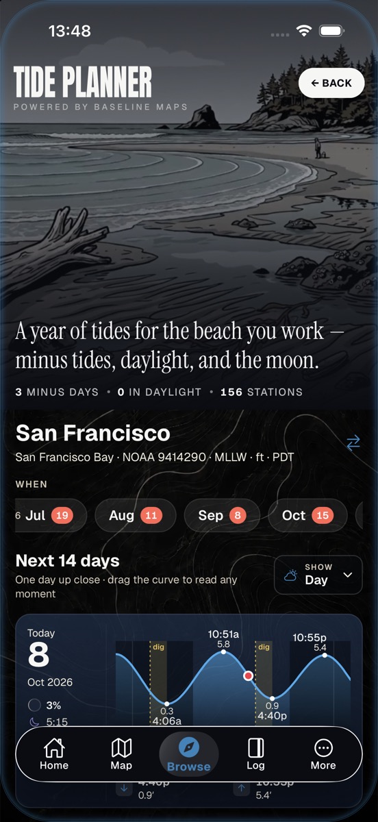
  • TidesA year of tides per station, minus days, daylight, moon
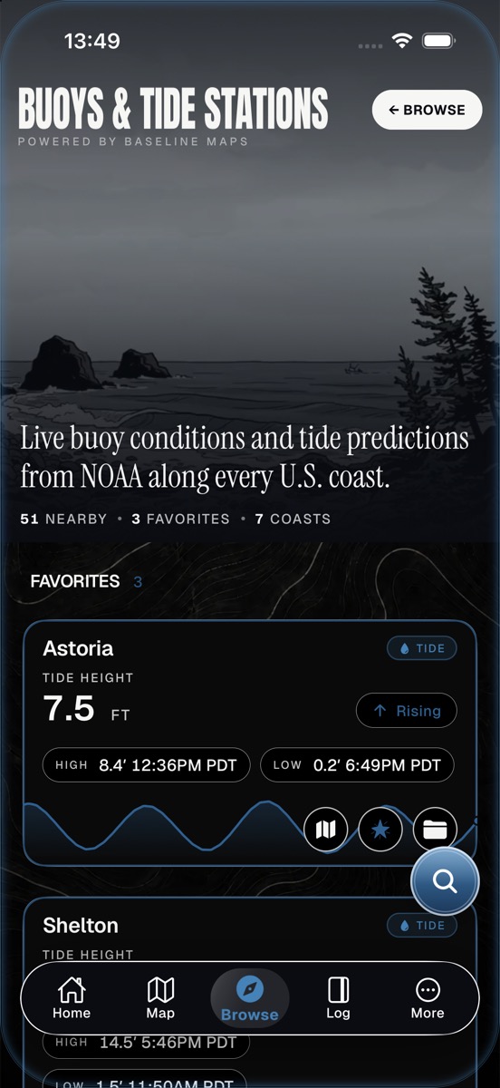
  • OceanNOAA buoys and tide stations along every U.S. coast
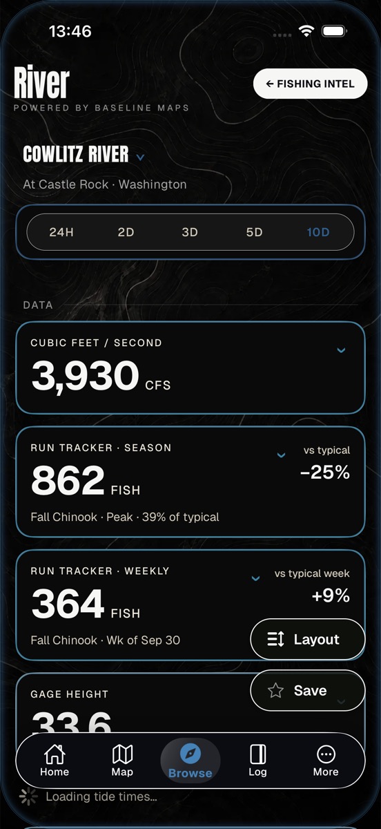
Cowlitz River at Castle Rock: 3,930 CFS, season run tracker at 862 fall Chinook, weekly count 364
River intelligenceCowlitz at Castle Rock / live
Tide Planner with month chips counting minus days and a 14-day tide curve
Tide planner156 stations / a year ahead
Buoys and Tide Stations: Astoria at 7.5 ft and rising, with high and low times
Buoys & tide stationsNOAA / 7 coasts
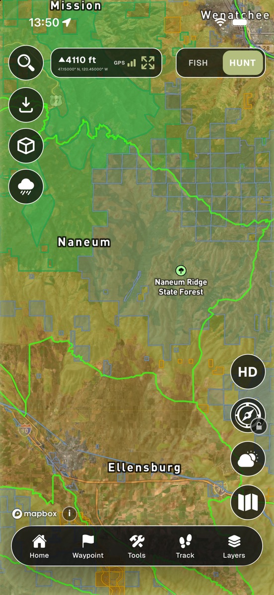
Hunt map over the Naneum unit near Ellensburg with GMU boundaries, public land, and section grid
GMU & land ownershipNaneum / WA
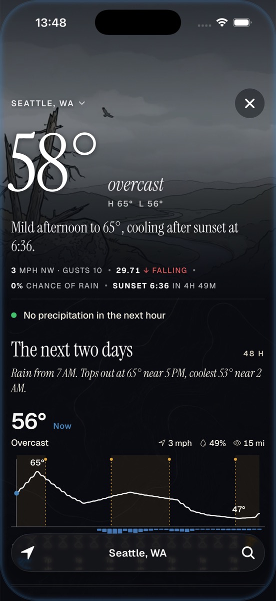
Weather: 58 degrees and overcast in Seattle, wind, pressure falling, and a 48-hour temperature curve
WeatherWind / pressure / 48 h
Ridgeline modeHunting

Every unit, every line, before you leave the truck.

1,300+ units across 11 Western states with parcel-level public vs private boundaries. Season dates by unit, and coverage keeps expanding.

  • UnitsGMU boundaries for 11 Western states
  • LandPublic land, PLSS grid, timberlands, OHV routes
  • RegsFull seasons live for WA, OR, ID, and MT
  • OfflineTopo, hillshade, satellite, parcels. Works without service.

Built by request

Every screen has a story. Most start with someone's feedback.

No roadmap committee. A feedback box, an Instagram DM line, and a list of people who voice-memo us at four in the morning. Here's what shipped recently because someone asked.

01

Driftline / Calawah River regular

“Calawah notes are kept in gauge feet, not CFS. Let me set the default per river.”

ShippedCFS / gauge feet toggle, defaulted per river.
02

Driftline / steelhead angler

“Water clarity is critical for steelhead. Add turbidity where USGS publishes it.”

ShippedTurbidity readings integrated from every USGS gauge that publishes them.

03

Driftline / Canadian user

“Show Celsius for Canadian rivers — we read conditions in C, not F.”

ShippedCelsius display option, available across every temperature reading.

04

Driftline / Niagara angler

“Niagara is a world-class fishery. It should be in the app.”

ShippedNiagara River added. Same week we added Michigan and Ontario stations from other requests.
By the numbers

Built on the data agencies publish. Refreshed every fifteen minutes.

1,300+

Rivers monitored

USGS gauges / 15-min refresh

1,300+

Hunting units

11 Western states

38+2

States + provinces

US + BC + Ontario

$34.99

Per year

First week free. All states.
Built for the field

Every screen reads at a glance. Sun, cold fingers, glove on.

Captured Oct 8, 2026 / app 1.2.96 / scroll →

Home, Fish mode
Home / FishNext 12 hours
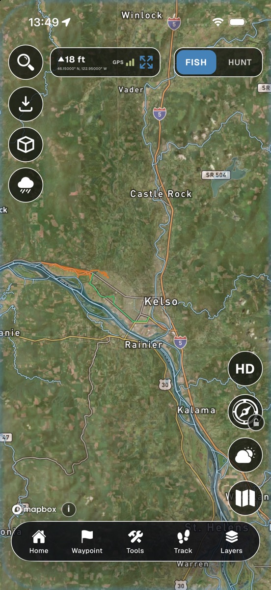
Fishing map on satellite along the Cowlitz and Columbia near Kelso
Driftline mapLower Columbia
Cowlitz River detail
River detailRun tracker
Tide Planner
Tide plannerMinus days
Buoys and tide stations
OceanNOAA stations
Weather
Weather48-hour curve
Home, Hunt mode
Home / HuntHunt intel
Ridgeline map
Ridgeline mapGMU + public land

App Store reviews

The people who carried it here.

■■■■■

Leagues Above the Rest

I have a few other apps for fishing and this has them all beat. The sheer amount of data provided is seriously impressive. Every update I find myself opening the app and trying to figure out what new feature was added.

Sinioth / Apr 14
■■■■■

Easy to use and keeps improving

I love that you can actually reach the developer and give input to help make Driftline better. That makes the app feel more personal and connected, like the people behind it really care.

Chris Prolite / May 5
■■■■■

Best app for 2026!

The company being quick to do updates and corrections when errors or bugs are found is why I’ve stuck with this app. I am finding myself using this app quite often to check river access and conditions.

L Stromskjold / Apr 2
■■■■■

Amazing app

I have been here since the beginning and the changes they have made to this app due to user requests is amazing. Day by day it is becoming a 1 stop shop app with features that are actually useful.

Anxiousanglersnw / Apr 14
■■■■■

Upping the ante, bit by bit!

I’ve been impressed with the ability to gather important data about whether I should get out fishing or not, and especially the ability to set custom alerts. Some of my favorite fishing is very dependent on conditions.

JEJagdfeld / Apr 2
■■■■■

Rapidly evolving like nothing else

This is such a useful app for fishing, hunting, shooting, and anything outdoor related. The thing that really puts it over the top is that if you have an idea or an improvement you just let them know.

.Chase.L / Apr 16
Read all reviews on the App Store

FAQ

Common questions.

What is Baseline Maps?
Baseline Maps is an outdoor mapping and intelligence app for fishing, hunting, and foraging. It combines real-time river flows, NOAA buoy data, tide charts, hunting GMU maps, land ownership, and state regulations into one app — built with input from the people who use it in the field every weekend.
What are Driftline and Ridgeline? Are they separate apps?
No. Driftline and Ridgeline are modes inside the Baseline Maps app, not separate apps. Driftline is the fishing and water mode; Ridgeline is the hunting and backcountry mode; Forage is the foraging mode. All three live in one app, and every edition includes all three. See how it works at baselinemaps.io/how-it-works.
Is Driftline the same as Baseline Maps?
It is the same app. Baseline Maps was originally released under the name Driftline when it only did fishing. As it grew to cover hunting and foraging, the app was renamed Baseline Maps, and Driftline became the name of the fishing mode. Older or regional App Store listings may still show the Driftline name; it is the same app.
How do I request a feature?
Three ways. The in-app feedback box (Settings → Feedback). DM us on Instagram @baselinemaps. Email info@getdriftline.com. We read every request, usually within a day. If it's a bug, we triage it that hour.
How fast do you ship?
Bug fixes ship within the same week. Smaller features ship in days. Larger ones land in a couple of weeks. We tell the requester first when their feature goes live.
What is a Founder?
Founders are the original beta users — the people whose voice memos, bug reports, and feature requests shaped the app. We text Founders before we ship design changes and credit them in the in-app Development Queue. It's recognition, not a marketing tier.
Is there a public roadmap?
Yes — open the Development Queue inside the app. Every shipped feature, every in-progress build, and every credit to the person who asked. We don't hide the roadmap behind a marketing wall.
How is Baseline Maps different from onX?
Baseline Maps covers fishing and hunting in one app, first week free, with one paid edition for every mode and state. It includes real-time river flows, tides, and buoy data, which onX Hunt did not include as of July 2026. And we build from member requests, tracked in the in-app Development Queue.
Does Baseline Maps work offline?
Yes. Download map regions for offline use including topo, satellite, hillshade, and land-ownership layers. Cached data is sized to your route.
What states does it cover?
Real-time river flows across 38 US states plus British Columbia and Ontario. Hunting GMU maps for 11 Western states: Washington, Oregon, Idaho, Montana, Colorado, Wyoming, Utah, Arizona, New Mexico, Nevada, and California. Full hunting regulations and seasons are live for Washington, Oregon, Idaho, and Montana. NOAA buoys across the US Pacific Coast. New states ship when users in those states ask.
How much does it cost?
Professional Edition is $34.99 per year, with the first week free, or $7.99 per month. It includes everything: maps, real-time river flows, land ownership, waypoints, regulations, offline maps, AI intel, forecasts, fish counts, radar, 3D, ballistics, and more. One edition covers every mode and every state, with no per-state surcharges. The Free Edition ended in October 2026; members who were on it get 20% off with code KEEPBASELINE through December 31, 2026.
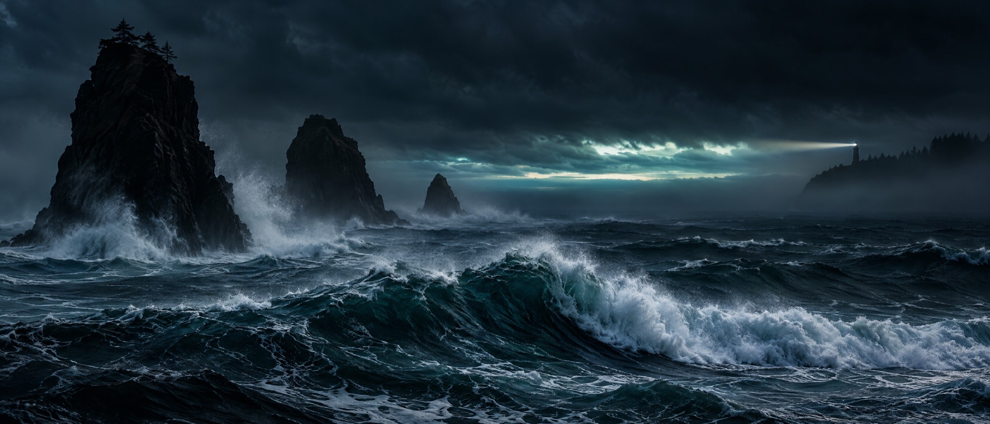
Heavy swell breaking on basalt sea stacks before dawn, a lighthouse beam in the fog

iOS + Android

One app. Water and ridge.

Fishing, hunting, and foraging modes in one app. Try Professional Edition free for a week, then keep offline maps, forecasts, and AI intel for the season.

Professional Edition $34.99 / year, first week free, or $7.99 / month / no per-state surcharges