GMU 245 Chiwawa
USFS-dominated Chiwawa and White River timber country: transitional mule deer, top-tier Chelan County black bear.
Region 2 — East Cascades / Chelan County · Last reviewed 2026-07-12
Area
569
sq mi
Public land
89%
approx.
Elevation
1,200–8,000
feet
Motorized
moderate
access
Overview
GMU 245 "Chiwawa" is a large (~580-square-mile) East Cascades unit in Chelan County built around Lake Wenatchee and the Chiwawa, White, and Wenatchee river drainages, with the Glacier Peak and Henry M. Jackson wildernesses forming its high western and northern edge and the Entiat Mountains its eastern border. It is overwhelmingly public — dominated by Okanogan-Wenatchee National Forest with an extensive network of old logging roads and trailheads off the Chiwawa and White River roads — with only small private tracts along the Wenatchee River and Chumstick valleys. Deer here are mostly transitional/migratory animals that summer high in the Glacier Peak Wilderness and move toward the Columbia breaks, plus a small resident population in the lower valleys. Its standout reputation is for black bear: along with the Mission unit it consistently produces the highest bear harvest in Chelan County.
Terrain
Rugged East Cascades relief: forested river valleys around Lake Wenatchee (~1,870 ft) and the lower Wenatchee/Chumstick corridors climb steeply through timbered ridges into high, rocky summer range along the Glacier Peak and Henry M. Jackson wilderness boundary and the Entiat Mountains crest. Old logging roads reach mid-elevations; the highest country is roadless wilderness accessed only by foot or horse.
Cover: Dense Douglas-fir, western hemlock, and true-fir timber on the wetter western and valley slopes, opening into subalpine parks and rock near the wilderness crest; drier ponderosa pine, bunchgrass, and brush toward the Entiat Mountains and Columbia breaks on the east. Timber-thinning cuts, old clearcuts, and burn scars (including the 2018 Cougar Creek fire on Tyee Ridge and the 2023 White River fire) create productive forage and berry-rich openings.
Landmarks: Lake Wenatchee (central) · Chiwawa River / Chiwawa River Road · White River / White River Road · Wenatchee River · Chumstick Valley and Chumstick Creek · Glacier Peak Wilderness (north/west boundary) · Henry M. Jackson Wilderness (western edge) · Entiat Mountains (eastern border) · Tyee Ridge (2018 Cougar Creek burn)
Access
Access is a strength here: the unit is roughly 89% public, dominated by Okanogan-Wenatchee National Forest with an extensive old-logging-road and trailhead network off the Chiwawa River Road and White River Road that reaches a wide range of elevations. The high western and northern country lies inside the Glacier Peak and Henry M. Jackson wildernesses, which are non-motorized (foot/horse only). The main access constraints are private inholdings along the Wenatchee River and Chumstick valleys — turkey and lower-valley deer often require private permission — plus seasonal fire and road closures. Carry a private/public boundary layer for the valley bottoms.
Managers: U.S. Forest Service — Okanogan-Wenatchee National Forest (dominant public landholder), Glacier Peak Wilderness / Henry M. Jackson Wilderness (USFS, non-motorized), Private — orchards, homes, and river tracts along the Wenatchee River, White River, and Chumstick valleys, Scattered WDNR and state parcels
Access points: Chiwawa River Road (FS Rd 6200) north from the Lake Wenatchee area into the upper Chiwawa drainage and trailheads · White River Road (FS Rd 6400) up-valley toward the Glacier Peak Wilderness · US 2 / Lake Wenatchee corridor from Leavenworth (primary approach) · Chumstick Highway (SR 209) and its many side roads/drainages
Species notes
Black Bear
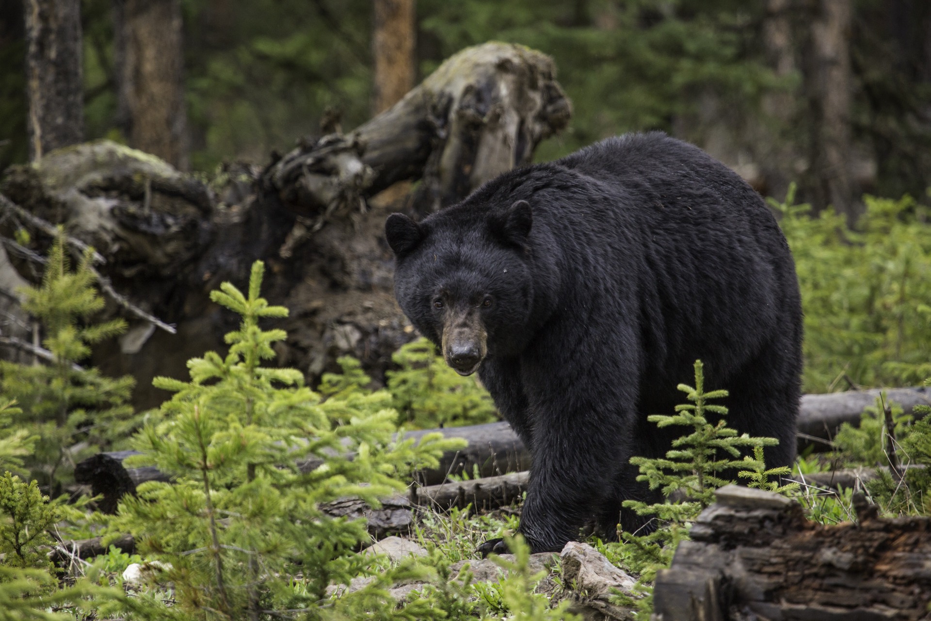
abundant qualityThe headline hunt. Along with the Mission GMU, Chiwawa consistently produces the highest black bear harvest in Chelan County, with excellent opportunity throughout the season around Lake Wenatchee and in the drainages running east-to-west off Chumstick Creek. The wet western timber and berry-rich burns support strong bear numbers.
- →Glass avalanche chutes, old clearcuts, and berry-laden burn regrowth (huckleberry, serviceberry) in the Chiwawa and White River drainages at first and last light.
- →Work the east-west drainages off Chumstick Creek and the brushy benches around Lake Wenatchee, where WDFW specifically flags bear opportunity.
- →Hunt the wetter, timbered upper drainages early in the season on ripe berry feed, then key on green forage after fall rains.
- →Spot-and-stalk off high glassing knobs — the open burns give you a chance to see a bear before it winds you in the thick timber.
Mule Deer
common qualityA fair-to-solid mule deer unit but a migratory one: most deer summer high in the Glacier Peak Wilderness and move seasonally toward the Columbia breaks, with only a small resident population in the Wenatchee River and Chumstick valleys. Modern-firearm success is modest (~7%) against heavy hunter numbers because bucks often stay high until after the general season; the 2024 antlered harvest still skewed toward mature deer (4- and 5-point bucks). Best results come from getting away from roads.
- →Hunt roadless and lightly-pressured pockets — WDFW notes the best success comes from areas without roads and pressure.
- →Early in the general season, work high timbered summer range near the wilderness boundary and the Slide Ridge (GMU 246) divide before deer have moved.
- →Late season, glass south-facing slopes near the snow line where bucks congregate as snow pushes them down.
- →Use the old-logging-road network to reach mid-elevation transition zones, then still-hunt and glass rather than road-hunting the crowded mainlines.
Cougar
common opportunityCougars occupy the timbered drainages throughout the unit wherever deer are present. Most are taken opportunistically by deer and bear hunters; deliberate cougar hunting is a late-season snow-tracking pursuit.
- →Hunt fresh snow to cut and follow tracks along ridgelines and drainage bottoms.
- →Concentrate where deer winter and transition, since cats follow the prey.
- →Glass rocky rims and breaks along the Entiat Mountains side where cougars travel and bed.
Rocky Mountain Elk
transient lowElk in GMUs 245-250 occur only at low densities in small, dispersed bands, and success is extremely low. A few elk use the Lake Wenatchee area, but this is not a unit to plan an elk hunt around.
- →Treat any elk as an opportunistic encounter while deer or bear hunting.
- →If pursuing them, work isolated timber pockets near the Lake Wenatchee basin and expect long odds.
Mountain Goat
limited trophyMountain goats inhabit the high, rocky wilderness country along the Glacier Peak / Henry M. Jackson boundary and the Entiat Mountains crest. Any goat hunting in Washington is a once-in-a-lifetime, draw-only permit in tightly defined hunt areas — not a general opportunity — and physically demanding backcountry work.
- →Permit-only: this is not a hunt you can plan around without drawing a mountain goat tag and completing WDFW's required gender-identification training.
- →If drawn, glass cliff bands, subalpine basins, and rocky ridgelines in the high wilderness country; plan for foot/horse access and multi-day backcountry logistics.
Pro tips
- →Come for the bear as much as the deer — Chiwawa is one of Chelan County's two best black bear units, best around Lake Wenatchee and the Chumstick Creek drainages.
- →Get off the road: the productive deer hunting is in roadless, low-pressure pockets high toward the wilderness, not on the crowded mainlines.
- →Time the deer hunt to weather — hunt high early, then chase snow onto lower south-facing slopes near the snow line late.
- →Use the extensive old-logging-road network on the National Forest to reach a range of elevations, then glass and still-hunt.
- →Carry a private/public boundary map for the Wenatchee River and Chumstick valleys — the public country is vast but the valley bottoms are checkerboarded with orchards and homes.
- →Check current fire/road closures before you go; these drainages close repeatedly during fire season.
Watch out for
- !Migratory herd: in a warm, dry fall the bucks may never come down during the general season, leaving low country empty and high country thinly scattered.
- !Heavy modern-firearm hunter numbers (nearly 600 in 2024) for a modest ~7% success rate — expect company and low road-hunting odds.
- !Fire and road closures are a recurring reality (2018 Cougar Creek on Tyee Ridge, 2023 White River fire); standing fire-killed snags are a falling hazard.
- !Private inholdings along the Wenatchee River and Chumstick valleys — turkey and lower-valley deer usually require private-land permission.
- !The unit lies within a grizzly bear recovery zone; know the difference between black and grizzly bears before hunting bear here.
- !Mountain goats and most quality opportunities are permit-only; the general hunt is honest opportunity hunting, not a guaranteed trophy unit.
Logistics
Stage out of Leavenworth or the Plain / Lake Wenatchee area on US 2; Wenatchee downriver is the largest hub for fuel, groceries, lodging, and gear. The Chiwawa River Road and White River Road provide the main up-valley access to trailheads and dispersed camping on Forest Service land, with developed campgrounds around Lake Wenatchee. Forest roads into the high country are rocky and some are unmaintained — high-clearance is wise and cell coverage drops fast off the highway corridor, so download offline maps with a boundary layer. Wilderness travel above the road ends is foot/horse only.
Nearest towns: Leavenworth, Plain, Lake Wenatchee, Cashmere, Wenatchee
Seasons & regulations
This page carries no season dates or regulations. Get current rules from the official Washington sources:
Research sources: WDFW — 2025 District 7 Hunting Prospects, Chelan & Douglas Counties (GMU 245 access, deer, bear, elk, harvest tables) · WDFW — Game Management Units (GMU 245 Chiwawa boundary & hunt planner) · GoHunt — Washington Unit 245 Chiwawa profile (89% public, elevation, terrain, species) · WDFW — Mountain Goat Special Permit Hunt Areas (once-in-a-lifetime, draw-only) · Okanogan-Wenatchee National Forest — Glacier Peak Wilderness (USFS)
FAQ
- How big is GMU 245 in Washington?
- GMU 245 (Chiwawa) covers about 569 square miles, ranging from roughly 1,200 to 8,000 feet in elevation. Area is computed from the unit boundary polygon.
- How much public land is in GMU 245?
- Approximately 89% of the unit is public land. Primary managers: U.S. Forest Service — Okanogan-Wenatchee National Forest (dominant public landholder), Glacier Peak Wilderness / Henry M. Jackson Wilderness (USFS, non-motorized), Private — orchards, homes, and river tracts along the Wenatchee River, White River, and Chumstick valleys, Scattered WDNR and state parcels. Always verify ownership boundaries on the ground.
- What species does the catalog list for GMU 245?
- Black Bear, Mule Deer, Cougar, Rocky Mountain Elk, Mountain Goat. For seasons, tags, and regulations, use the official Washington agency resources linked on this page — this page carries no regulatory information.
Put GMU 245 on your map.
Boundary lines, public/private ownership, topo, and offline maps for this unit — in Baseline Maps, free for 14 days.